|
On the Track |
Katoomba to Jenolan in a day – the Six Foot Track
Peter Caldwell
President, Sydney Branch of NPA
Katoomba to Jenolan in a day – the Six Foot Track Peter Caldwell |

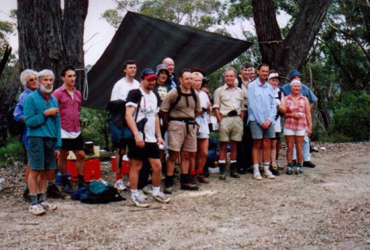
The walkers have a break at the Pluvio Hilton
Saturday 1 April 2000. (An April fool? No, it really did happen!) Eighteen fit, intrepid starters left the Explorer’s Tree just after 6 am, the weather surprisingly cool after the real scorcher the day before, led by Richard Thompson. The first part of the walk is a steep descent by steps into Nellies Glen; the valley which shortly follows Megalong Creek levels out onto a fire trail. The walking track leaves this trail on its way to the crossing with the Megalong Road, 8km on. A break here for morning tea at 7.45am is provided by the back-up crew.
The track then enters open farmland with a few short sharp hills and some stiles and gates before the most natural and wooded part of the walk, a steady descent on a walking track following the line of the Coxs River for about 4km to the lowest point, 780m below the Explorer’s Tree. There is a long one-person swing bridge, but this takes too long for a large group so rock hopping and wading is the way across the river near the junction with Murdering Creek.
The track now reverts to a wide fire trail following this creek and the first of the two major ascents with Gibraltar Sugarloaf up to the right. After a steep climb of 450m in about 3km Mini Saddle is reached, only to drop 160m to the crossing of Little River. Another steep climb of 430m never seems to end as it winds up the hill to the Black Range ridge at the Pluviometer. At 25 km this is a little over half-way but the last of the major hills. A well-earned break for lunch with orange juice, hot tea, cake and water refills, again provided by the back-up crew. This year the walkers were ahead of schedule, all making it to the top in fine style. When rain threatened the tarp was quickly erected and once again the "Pluvio Hilton" was in place – Richard had so christened it in 1999 when it did rain.
After lunch there is still another 220m of climb to the highest point on Black Range at 1210m, but this is gained in 8km so it is hardly noticeable. Another 1km of gentle descent through the pine plantations brings one to the picnic spot in the pine trees at the side of the Jenolan Caves road and afternoon tea.
After nearly 5km of undulating road walking there is the turn-off to Binda Cabins behind Kiaora Hill to follow the Binoomea Ridge. The last 2km is a steep descent of 320m with beautiful views of the valleys to the west. Care is needed so tired feet do not slip on the loose rocks. Before the final descent on a graded "tourist" track to Caves House, there is the magnificent view through Carlotta’s Arch to the brilliant blue of the lake and the Jenolan River.
After a welcoming drink and a shower everyone looked fit enough to walk back to Katoomba!
A delightful social evening over a BBQ prepared by Steve and Susan was followed by the annual evening walk through the Grand Arch and Devil’s Coach House to the top of Carlotta’s Arch.
After Richard’s earlier worries when the walker numbers seemed to be approaching thirty, there were plenty of car spaces for everyone the next morning to return home.
Walkers Richard Thompson (Leader), Marc Allas, Pamela & Darryl Warren, Joan Sherrin, Michael Donnelly, Warwick Bridge, Jo Ajanovic, Helen Litchfield, Helmut Pfiel, Grahame Harris, Jamie Doran, Jason Wagg, Gordon Wynn, Werner Werner, Tami Telford, Ben Whatman, Carole Beales.
Helpers & back-up crews Steve Bennetts, Susan Sinclair, Geoff Farrell, Vivien Dunne, Peter Caldwell, Chris Daley, Alan Gow, Elaine Pfiel.
Special thanks to Richard Thompson and Steve Bennetts for their organisation.
|
|
National
Parks Association - Home Page |
|